Thunderstorms expected on last week of September
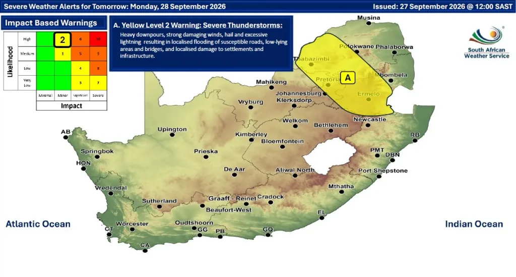
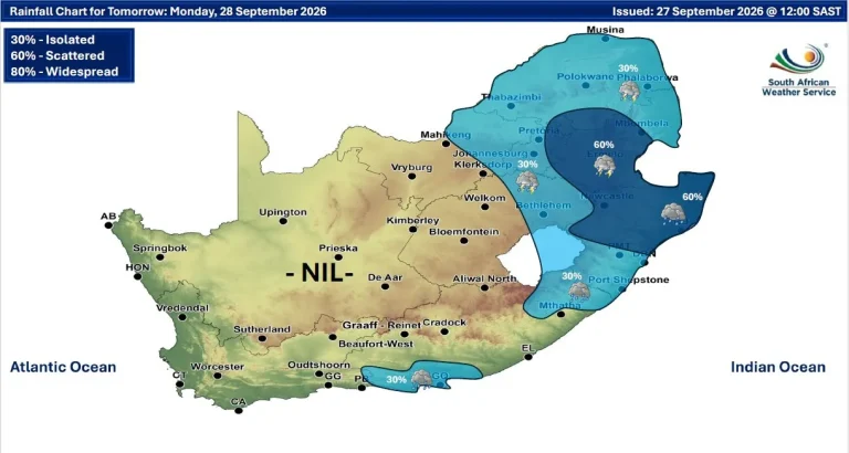
The South African Weather Service has warned that isolated to scattered thunderstorms are likely over the eastern parts of the country, with heavy rainfall expected to increase the risk of localised flooding on Monday and Tuesday

South Africans can expect partly cloudy and warm weather across most of the country over the next few days, although cooler conditions are forecast for parts of the southeastern regions.
The South African Weather Service has warned that isolated to scattered thunderstorms are likely over the eastern parts of the country, with heavy rainfall expected to increase the risk of localised flooding on Monday and Tuesday.
The warning includes parts of Mpumalanga, KwaZulu-Natal, Limpopo and Gauteng, where heavy downpours could lead to flooding of low-lying areas, roads and bridges. Strong winds, hail and excessive lightning may also accompany the storms, potentially causing damage to settlements and infrastructure.
According to the weather outlook, much of the country will remain warm, while cooler conditions are expected in the southeastern parts. Rainfall is expected to be isolated to scattered across the eastern interior as the weather system moves through the region.
Motorists are urged to exercise caution during periods of heavy rain, avoid driving through flooded roads and stay alert for rapidly changing weather conditions. Residents living in flood-prone areas are advised to monitor weather updates and follow instructions from local authorities should conditions deteriorate.
The South African Weather Service will continue to monitor the developing weather system and provide updates as necessary.