South Africans are being urged to prepare for a week of typical winter weather after the South African Weather Service (SAWS) forecast widespread cold conditions, rainfall and strong, damaging winds from Wednesday (July 1) across the central and southern parts of the country.
According to SAWS, the opening July weather will be partly cloudy and cool to warm in most areas, with isolated showers and rain expected in the southern and south-eastern regions. Scattered showers are also forecast along parts of the Eastern Cape coastline.
The weather service has issued a warning for damaging waves along the KwaZulu-Natal coast, while a strong cold front is expected to move across the country later in the week.
The cold front is forecast to bring strong surface winds to the north-western parts of South Africa, increasing the risk of localised damage to formal and informal settlements. The severe winds could also lead to falling trees, disruptions to transport routes and travel services, and localised agricultural losses.
A separate warning has also been issued for damaging waves along the Eastern Cape coastline. West-to-south-west swells with wave heights of between four and five metres, accompanied by winds of up to 30 knots (about 60km/h), are expected between Plettenberg Bay and Port Edward as the cold front moves along the coast.
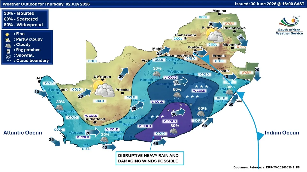
Looking midweek, conditions are expected to bring partly cloudy skies, with isolated to scattered showers and thundershowers over the central, western and eastern parts of the country.
Temperatures are also expected to drop significantly, with cold to very cold conditions forecast over the western interior on Wednesday, while the rest of the country is expected to remain fine and cool.
Motorists, coastal communities, farmers and residents in areas vulnerable to strong winds are advised to monitor the latest weather updates and take the necessary precautions as the cold front moves across the country.